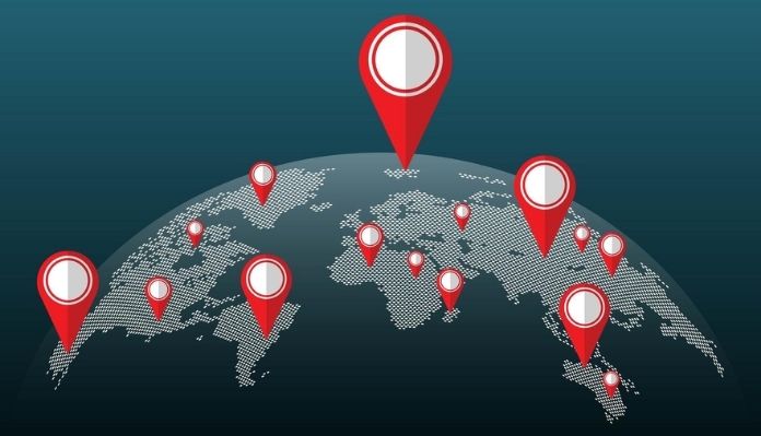
Understanding ZIP and Postal Codes Around the World
If you've ever traveled, relocated, or shipped something to another country, you've likely observed that postal codes are not the same in every place.
Some are small, some use letters, while some are actually quite long.
Understanding how ZIP and postal codes work around the world can save time, prevent delivery issues, and make travel planning smoother.
Let’s take a closer look at how these systems differ and why they’re more important than you might think.
What Are ZIP and Postal Codes?
Zip Code stands for Zone Improvement Plan, which was implemented in 1963 by the United States Postal Service (USPS).
They are mainly used to identify exactly where parcels or letters need to be delivered.
This is done by categorizing regions into basic geographic zones to easily route letters to their desired destinations.
A postal code is a coding system used by several countries around the world to facilitate automatic mail sorting.
It represents the delivery jurisdiction, meaning there is a single postal code for many delivery locations within the same jurisdiction.
There is an area-wise allocation of postal codes for this reason, and each postal code is linked to a particular geographical region.
How ZIP and Postal Codes Work in Different Countries?
Although Zip and postal codes perform the same task universally, their pattern and structures vary from country to country.
Below, we break down global ZIP codes in a simple manner, using easy-to-follow examples.
1. United States: ZIP Codes and ZIP+4 Explained
The U.S. uses five-digit ZIP codes to identify general delivery areas. For more precise locations, the ZIP+4 format adds four extra digits.
Example:
- ZIP Code: 10001 (New York, Manhattan area)
- ZIP+4: 10001-0001 (specific building or block)
ZIP+4 codes have become popular with companies, particularly with courier companies, to enable faster and more accurate delivery of packages or shipments.
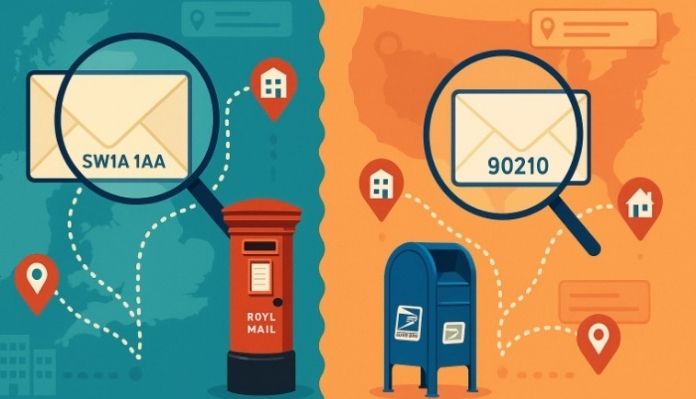
2. United Kingdom: Postcode System Overview
UK postcodes combine letters and numbers, making them very specific. A single postcode can represent just a few houses or even one building.
Example:
- SW1A 1AA (Buckingham Palace, London)
The first part gives the postcode area, and the second one defines the exact location.
3. Canada: Letter-Number Postal Code Format
Canadian postal codes follow an alphanumeric pattern written as A1A 1A1. Each section provides more location detail.
Example:
M5V 3L9 (Toronto, Ontario)The first three characters identify the region, and the last three specify a local delivery area.
4. Australia: Postal Code System
Australia uses four-digit postal codes to identify states, cities, and regions.
Example:
- 2000 (Sydney, New South Wales)
- 3000 (Melbourne, Victoria)
Lower numbers often represent major cities, while higher numbers are assigned to regional and rural areas.
5. India: PIN Codes and Their Structure
There is a high degree of structure to India’s six-digit PIN codes (Postal Index Numbers), with each digit corresponding to a different level of geography.
Example:
- 110001 (New Delhi)
The digits indicate the region, sub-region, sorting district, and delivery post office.
6. Other Countries: Different Postal Code Systems
Many countries follow unique postal code formats based on their needs.
Examples:
- Germany: 10115 (Berlin) – numeric system
- Japan: 100-0001 (Tokyo) – includes a hyphen
- France: 75001 (Paris) – five-digit numeric code
Each system is designed to improve accuracy and efficiency in mail delivery.
Key Differences Between ZIP Codes and Postal Codes
| ZIP Codes | Postal Codes |
|---|---|
|
|
|
|
|
|
|
|
Why Knowing ZIP and Postal Codes Is Important?
Though seemingly inconspicuous, ZIPs and postal codes are a part of our everyday lives.
First and foremost, their main purpose is to ensure correct shipping and delivery.
Their usage helps in quick, timely dispatch at appropriate addresses without any damage or discrepancies that may occur in case of a delay or misplacement
They’re also useful for travel planning and navigation. Many maps, GPS tools, and travel apps rely on postal codes to pinpoint locations, guide you to the correct neighborhood, and help you find nearby services with ease.
In addition, ZIP and postal codes are commonly required for online forms, registrations, and location-based services.
Whether you are shopping online, signing up for an account, or trying to see if the service is available in your area, it helps everything work smoothly and accurately if you put the proper code.
How to Find ZIP and Postal Codes Globally?
- Step 1: Open AZipCode.com: Visit AZipCode official website on your computer or mobile device to start searching.
- Step 2: Use the Location Finder: Click “Find My ZIP Code” and allow the site to access your location for automatic detection.
- Step 3: View Your ZIP/Postal Code: The website will display your current ZIP or postal code along with location details instantly.
- Step 4: Search Manually for Other Locations: If you need a ZIP/postal code for a different city, street, or country, use the search box to enter the address.
- Step 5: Explore Advanced Features (Optional): You can also use maps, convert coordinates to postal codes, or find codes worldwide for travel, shipping, or planning purposes.
Wrapping Words
Now that you understand ZIP and postal codes around the world, it’s time to put that knowledge to work.
Use tools like AZipCode to find accurate codes, explore new areas, and make travel, shipping, or planning easier than ever.